Initiative de l’ESA sur le changement climatique Couverture terrestre à une résolution spatiale de 300 m
Date modified: October 2022
Présentation du produit
Aperçu
Digital Earth Africa (DE Africa) provides free and open access to a copy of ESA’s Climate Change Initiative Land Cover product over Africa for 1992-2022.
Parmi de nombreuses utilisations potentielles, le produit CCI Land Cover vise à :
s’appuyer sur le système de classification de la couverture terrestre (LCCS) de l’Organisation des Nations Unies pour l’alimentation et l’agriculture (FAO) dans un souci de compatibilité avec d’autres produits de couverture terrestre ;
répondre aux besoins des communautés de modélisation du climat et des flux mondiaux de carbone.
Les cartes de l’ICC ont été conçues pour être cohérentes à l’échelle mondiale. Par conséquent, leur légende de « niveau 1 » a été déterminée par le niveau d’information disponible et qui avait du sens à l’échelle du monde entier. Cette légende de « niveau 1 » est celle exprimée par dix valeurs (c’est-à-dire des valeurs de classe de 10, 20, 30, etc.). Les cartes d’occupation du sol ont également été décrites par une légende plus détaillée, dite de « niveau 2 », qui correspond aux valeurs non décennales (c’est-à-dire des valeurs de classe de 11, 12, 61, 62, etc.). Cette légende de « niveau 2 » a utilisé des informations plus précises et régionales lorsqu’elles étaient disponibles.
Des informations supplémentaires sont disponibles sur le site Web de l’ESA Landcover CCI <https://www.esa-landcover-cci.org/> et dans le manuel d’utilisation <http://maps.elie.ucl.ac.be/CCI/viewer/download/ESACCI-LC-Ph2-PUGv2_2.0.pdf>. Un bloc-notes Jupyter <https://github.com/digitalearthafrica/deafrica-sandbox-notebooks/blob/main/Datasets/Landcover_Classification.ipynb> qui montre le chargement et l’utilisation des ensembles de données de couverture terrestre dans le Sandbox est également disponible.
Spécifications
Couverture spatiale et temporelle.
Les métadonnées pertinentes pour le produit ESA Climate Change Initiative Land Cover at 300m peuvent être consultées sur l’explorateur de métadonnées DE Africa <https://explorer.digitalearth.africa/products/cci_landcover>`__.
Tableau 1 : Spécifications du produit de l’Initiative sur le changement climatique de l’ESA sur la couverture terrestre à 300 m.
Spécification |
|
|---|---|
Nom du produit |
|
Taille de la cellule - X (degrés) |
-0,003° (~300m) |
Taille de la cellule - Y (degrés) |
-0,003° (~300m) |
Système de référence de coordonnées |
EPSG:4326 |
Résolution temporelle |
Annuel |
Plage temporelle |
1992-2022 |
Fréquence de mise à jour |
Annuel |
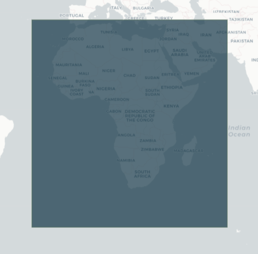
Les étendues temporelles et géographiques spécifiques du produit peuvent être explorées sous forme de carte interactive sur l’explorateur de métadonnées DE Africa <https://explorer.digitalearth.africa/products/cci_landcover>. Les données sont disponibles pour la région ombrée en bleu.
Figure 1 : Couverture terrestre de l’Initiative sur les changements climatiques de l’ESA à une distance géographique de 300 m.
Mesures
Tableau 2 : Mesures du produit Couverture terrestre à 300 m de l’Initiative sur les changements climatiques de l’ESA.
ID de la bande |
Description |
Unités |
Gamme |
Type de données |
Aucune donnée\(^\dagger\) |
|---|---|---|---|---|---|
classification |
Classe LCCS |
1 |
0 - 220 |
uint8 |
255 |
\(^\dagger\) Aucune donnée ni valeur de remplissage.
Traitement
Les cartes de couverture terrestre de l’Initiative sur le changement climatique de l’ESA ont été réalisées avec une prédominance d’images MERIS FR. Le jeu de données MERIS RR a également été utilisé pour compenser le manque d’acquisitions MERIS FR dans certaines zones et d’observations acquises par SPOT. La végétation (SPOT-VGT) a été utilisée pour étendre la couverture temporelle du projet sur les années 1998-2002.
Le document « Cartographie globale pluriannuelle de la couverture terrestre à 300 M et caractérisation pour la modélisation climatique » <https://research.wur.nl/en/publications/multi-year-global-land-cover-mapping-at-300-m-and-characterizatio> et le document-cadre sur la cartographie de la couverture terrestre <https://ieeexplore.ieee.org/abstract/document/6351640> décrivent les chaînes de prétraitement et de classification utilisées pour produire la distribution la plus récente des cartes de couverture terrestre.
Médias et exemples d’images
Figure 2 : Données de classification de la couverture terrestre du CCI pour Madagascar.
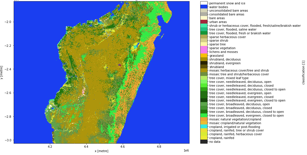
Crédit : Contient le produit CCI Land Cover 300m avec l’aimable autorisation de l’Initiative sur les changements climatiques de l’ESA, traité par Digital Earth Africa.
Références
Bontemps, P. Defourny, C. Brockmann, M. Herold, V. Kalogirou et O. Arino, « Nouvel exercice de cartographie de la couverture terrestre mondiale dans le cadre de l’Initiative sur le changement climatique de l’ESA », Symposium international IEEE sur les géosciences et la télédétection 2012, 2012, pp. 44-47, https://doi.org/10.1109/IGARSS.2012.6351640.
Bontemps, S., Boettcher, M., Brockmann, C., Kirches, G., Lamarche, C., Radoux, J., Santoro, M., Van Bogaert, E., Wegmüller, U., Herold, M., Achard, F., Ramoino, F., Arino, O., & Defourny, P. (2015). Cartographie globale pluriannuelle de la couverture terrestre à 300 M et caractérisation pour la modélisation du climat : réalisations du volet couverture terrestre de l’initiative de l’ESA sur les changements climatiques. Dans Archives internationales de la photogrammétrie, de la télédétection et des sciences de l’information spatiale - Archives de l’ISPRS (Vol. XL-7/W3, pp. 323-328). Société internationale de photogrammétrie et de télédétection. https://doi.org/10.5194/isprsarchives-XL-7-W3-323-2015
Licence
En tant que produit officiel de la politique de données de l’ESA CCI, l’accès à ce produit est gratuit et ouvert à tous les utilisateurs.
Remerciements
Cette base de données CCI-LC a été traitée par le consortium CCI-LC dirigé par UCL-Geomatics (Belgique). Les recherches ayant conduit à la version actuelle du produit ont été menées par le projet ESA CCI Land Cover.
Accès aux données
Amazon Web Service
Le produit ESA Climate Change Initiative Land Cover at 300 m est disponible dans AWS S3.
Tableau 3 : Détails d’accès aux données AWS.
Détails AWS S3 |
|
|---|---|
Seau ARD |
|
Région |
|
Le bucket se trouve dans la région AWS « af-south-1 » (Le Cap). Des spécifications de région supplémentaires peuvent être appliquées comme suit :
aws s3 ls --region=af-sud-1 s3://deafrica-input-datasets/
Les chemins d’accès aux fichiers suivent le format : s3://deafrica-input-datasets/cci_landcover/<year>/.
Services Web OGC (OWS)
Le produit Couverture terrestre à 300 m de l’Initiative sur le changement climatique de l’ESA n’est pas encore disponible via l’OWS de Digital Earth Africa.
Open Data Cube (ODC)
Le produit Couverture terrestre à 300 m de l’Initiative sur le changement climatique de l’ESA est accessible via l’API ODC de Digital Earth Africa, qui est disponible via le « Digital Earth Africa Sandbox <https://sandbox.digitalearth.africa/hub/login> »__.
Nom du produit ODC : « cci_landcover »
Des bandes de données spécifiques peuvent être appelées en utilisant soit les noms par défaut, soit l’un des noms alternatifs d’une bande, comme indiqué dans le tableau ci-dessous. Les commandes ODC Datacube.load sans bandes spécifiées chargeront toutes les bandes.
Tableau 4 : noms des bandes de produits ODC cci_landcover.
Nom du groupe |
Noms alternatifs |
Remplir la valeur |
|---|---|---|
classification |
classe |
« 255 » |
Informations techniques
La précision globale globale en 2015 était de « 75,4 % ».
Des informations complémentaires sur la validation et la précision peuvent être trouvées dans le « Guide de l’utilisateur du produit CCI sur la couverture terrestre version 2.0 <http://maps.elie.ucl.ac.be/CCI/viewer/download/ESACCI-LC-Ph2-PUGv2_2.0.pdf> ».